Sky map
Real sky imagery from astronomical surveys. Drag to pan, scroll to zoom, type an object name to fly there.
Centred on The Galactic Centre17 45 40.04 -29 00 28.2
Objects worth a look
The Solar System in real images
Planets do not sit still on the star map above: they travel along the ecliptic and move every night, so no fixed coordinate can describe them. Below are images taken by spacecraft and telescopes. Where CDS publishes a surface map, click the image to rotate and zoom into it.
The Sun
- G-type dwarf star
- Hydrogen fusion
- 1,392,680km
- Diameter
The central star holding 99.86% of the system mass, fusing hydrogen into helium continuously for 4.6 billion years.
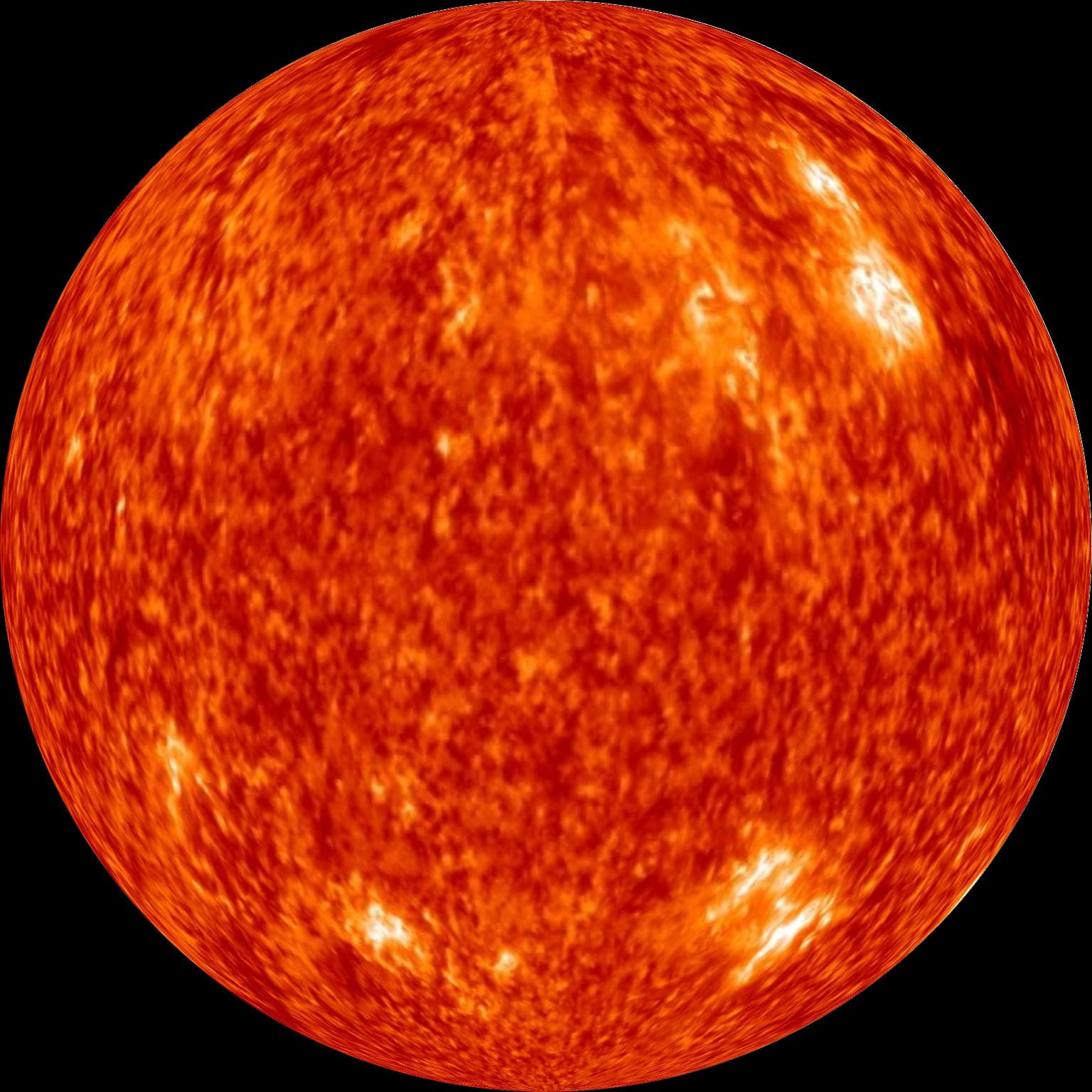
Whole-Sun spherical map at 304 Å in the extreme ultraviolet — the chromosphere. Assembled by CDS from a NASA/GSFC movie tracking the entire surface between 1 January and 27 September 2012. The orange is false colour: the eye cannot see this wavelength. Click to rotate this very map.
Data source: NASA · CDS · GSFC
The system’s central star
Mercury
- Rocky planet
- 600 °C swing
- 4,879km
- Diameter
- 58million km
- Distance from the Sun
- 0
- Moons
The smallest planet and the closest to the Sun. With almost no atmosphere, its day-night temperature swing reaches 600°C.
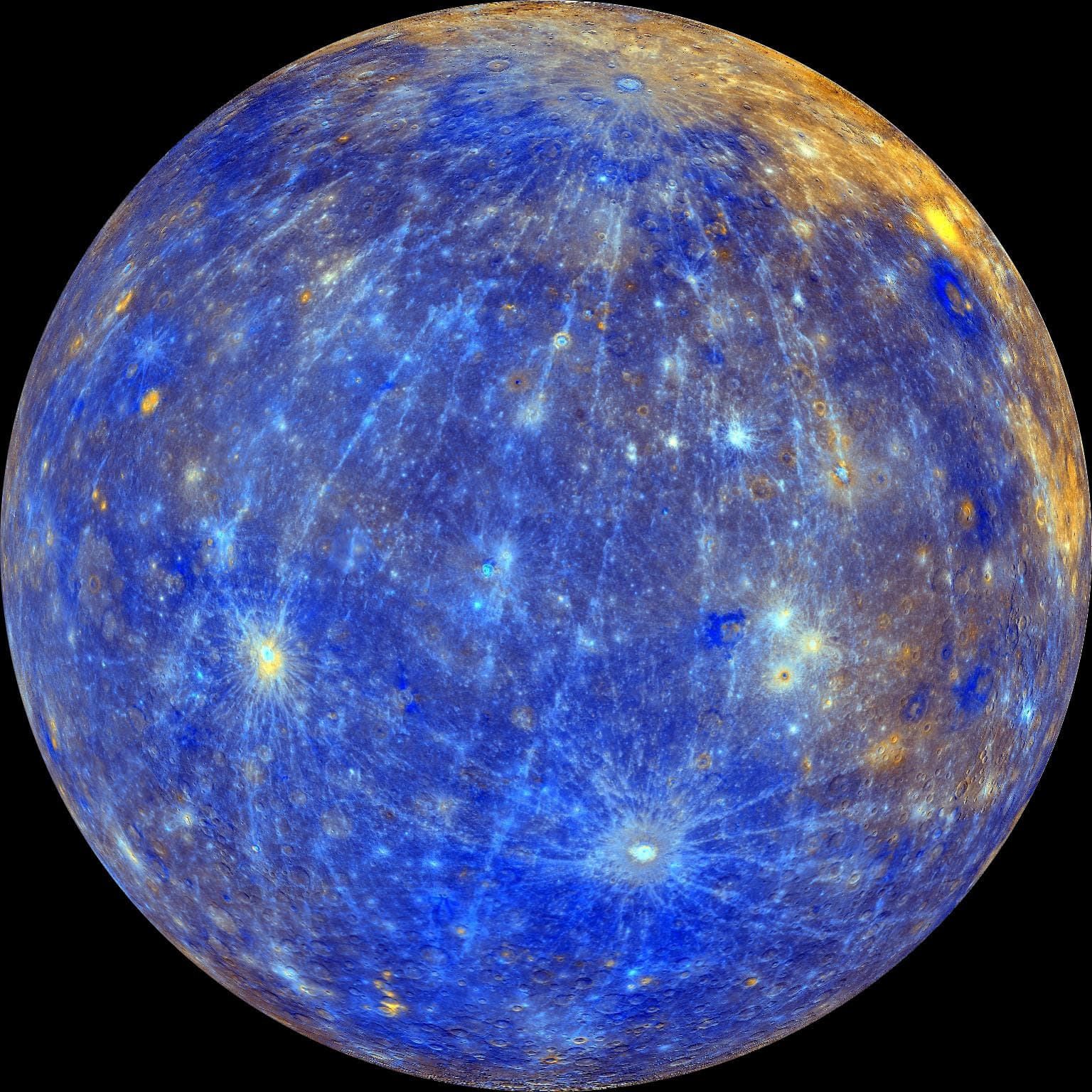
Not what the eye would see — to the naked eye Mercury is as grey as the Moon. This is an enhanced-colour mosaic from MESSENGER's MDIS: the 430, 750 and 1000 nm bands run through a principal-component analysis and mapped to red, green and blue, which pulls apart rock types the eye cannot separate. Click to rotate this very map.
Data source: NASA · USGS · CDS
Position #1 from the Sun
Venus
- Rocky planet
- Sulfuric-acid cloud
- Runaway greenhouse
- 12,104km
- Diameter
- 108million km
- Distance from the Sun
- 0
- Moons
The hottest planet, thanks to a runaway greenhouse effect in its dense CO₂ atmosphere. It spins backwards relative to most other planets.
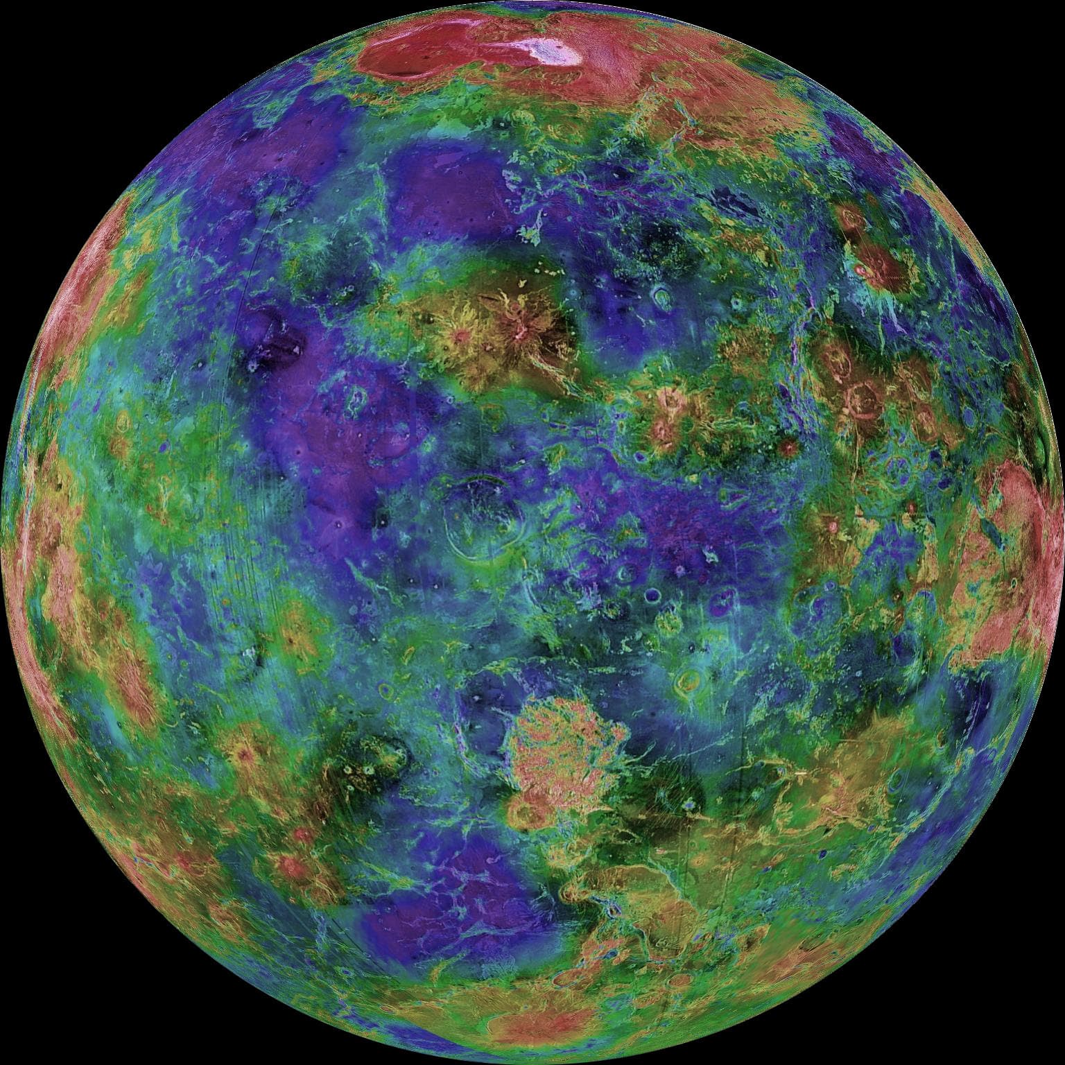
Neither true colour nor anything visible from outside: sulfuric-acid cloud hides Venus completely. This is the surface beneath, mapped by Magellan's cloud-piercing radar, with colour coding elevation — blue for low plains, red for highlands. Click to rotate this very map.
Data source: NASA · JPL
Position #2 from the Sun
Earth
- Rocky planet
- Liquid water
- Hosts life
- 12,742km
- Diameter
- 150million km
- Distance from the Sun
- 1
- Moons
The only planet known to host life, with liquid surface water and a magnetosphere shielding it from the solar wind.
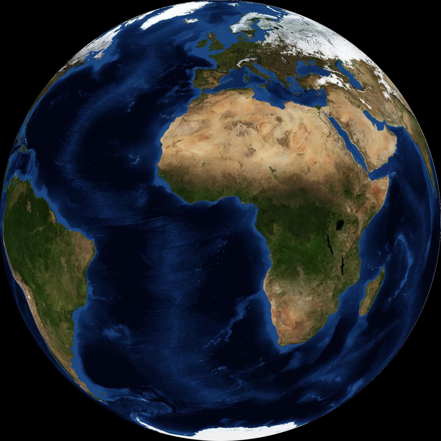
NASA's Blue Marble: composed from MODIS satellite data, each pixel taken from the clearest day of the month, so no cloud hides the ground. This is the real surface in visible light. Click to rotate this very map.
Data source: NASA
Position #3 from the Sun
The Moon
- Natural satellite
- Near-vacuum
- Tidally locked
- 3,475km
- Diameter
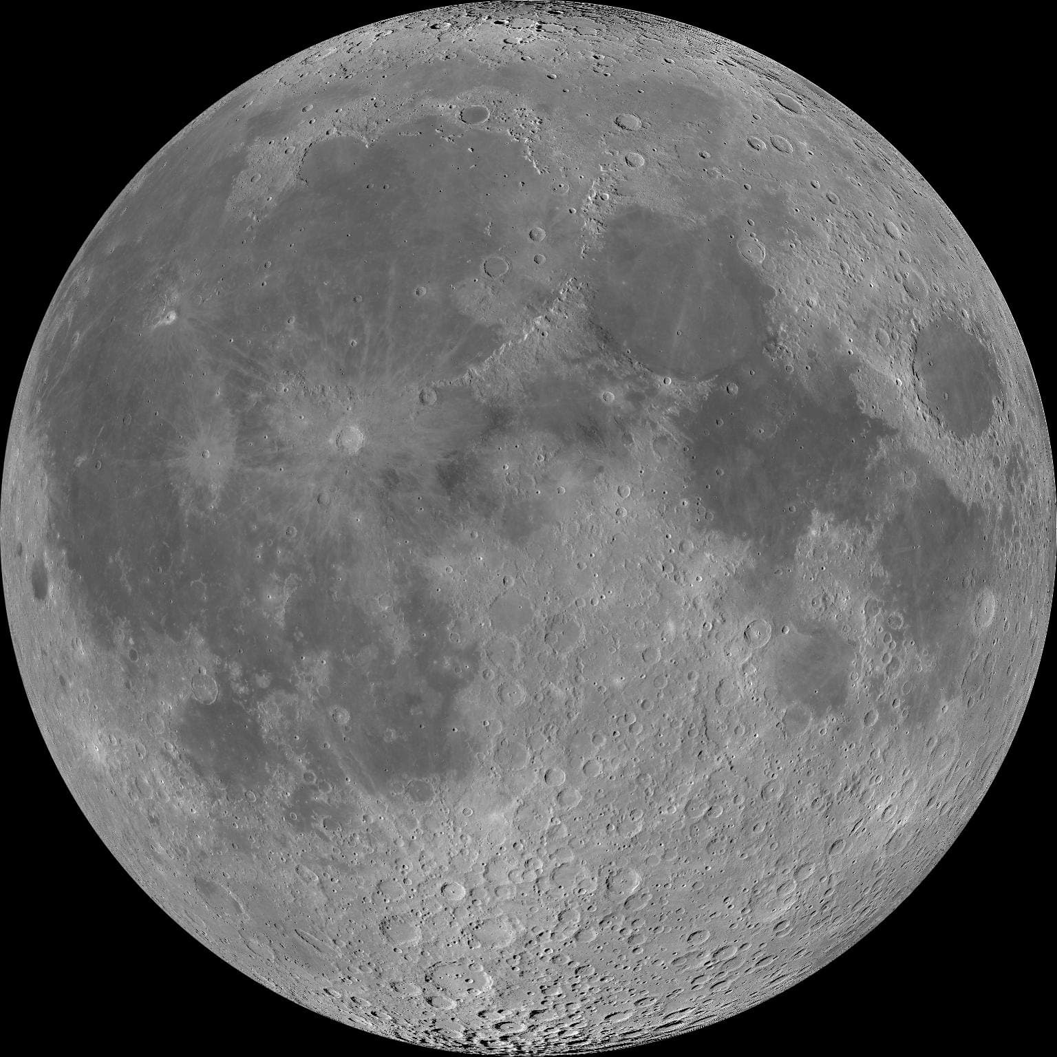
Earth's only natural satellite, 384,400 km away. It keeps one face turned toward us because its spin is locked to its orbital period.
Global morphologic map from the Wide Angle Camera on Lunar Reconnaissance Orbiter, 100 m per pixel. The dark region around the north pole is genuine shadow — the Sun never rises far above the horizon there — not missing data. Click to rotate this very map.
Data source: NASA · GSFC
Earth’s natural satellite
Mars
- Rocky planet
- Water ice
- Exploration target
- 6,779km
- Diameter
- 228million km
- Distance from the Sun
- 2
- Moons
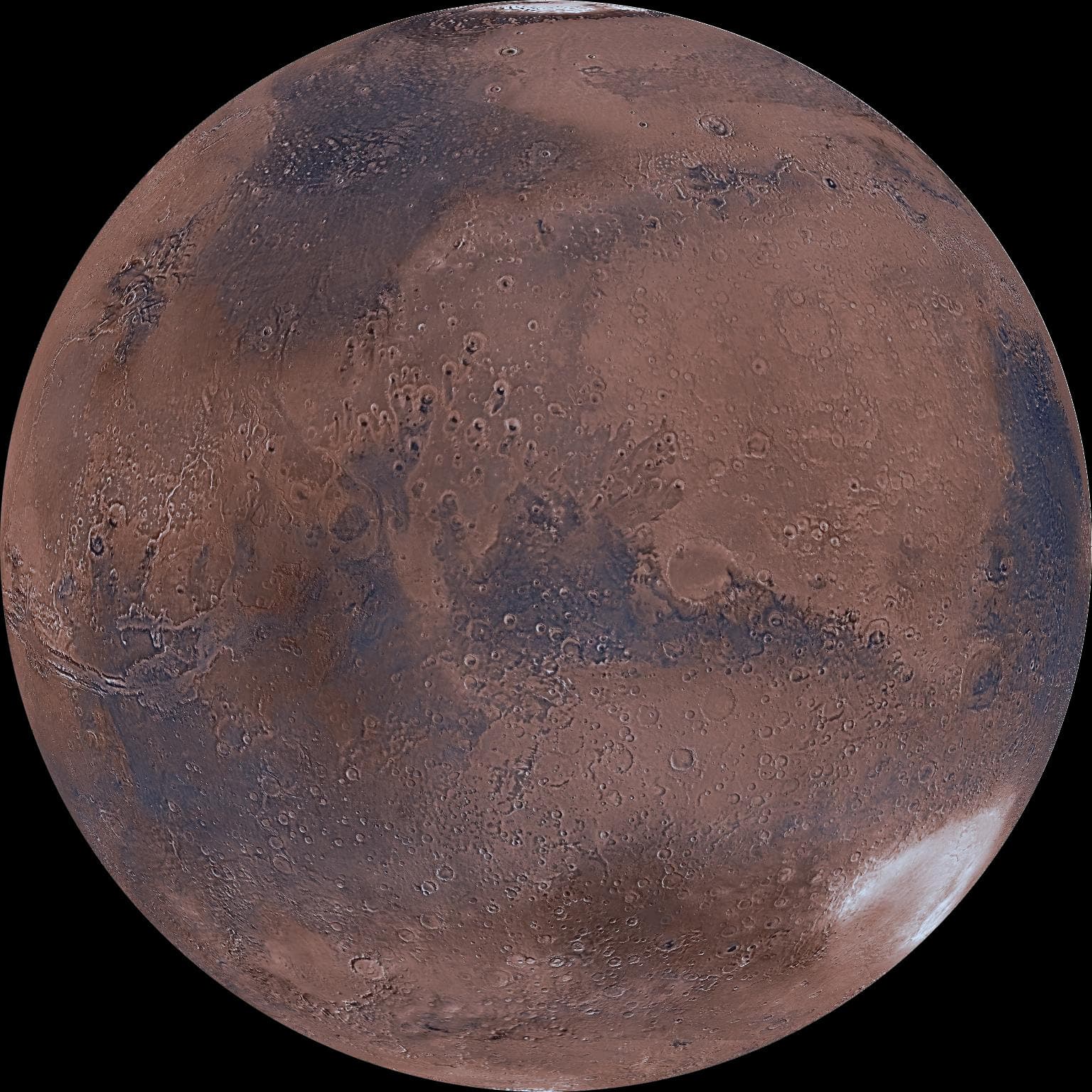
Its red colour comes from surface iron oxide. It hosts Olympus Mons, the tallest volcano in the Solar System.
Colour mosaic from the Viking orbiters — the USGS MDIM 2.1 basemap at 232 m per pixel. The north polar cap sits at the top; the dark streak across the middle is Syrtis Major. Click to rotate this very map.
Data source: NASA · USGS
Position #4 from the Sun
Jupiter
- Gas giant
- The Great Red Spot
- 139,822km
- Diameter
- 779million km
- Distance from the Sun
- 95
- Moons
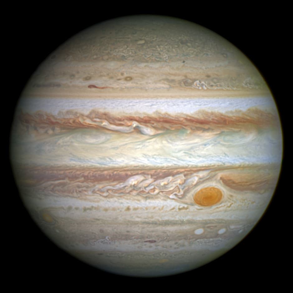
The largest planet, 2.5 times the mass of every other planet combined. The Great Red Spot is a storm centuries old.
Hubble, from its outer-planet monitoring programme. The Great Red Spot has been shrinking year on year.
Data source: NASA · ESA · GSFC
Position #5 from the Sun

Saturn
- Gas giant
- The clearest ring system
- 116,464km
- Diameter
- 1,432million km
- Distance from the Sun
- 146
- Moons
Famous for rings of ice and rock spanning hundreds of thousands of kilometres yet only about ten metres thick in places.
A Cassini mosaic of dozens of frames taken at the 2009 equinox, when sunlight grazed the ring plane and every ripple cast a long shadow.
Data source: NASA · JPL
Position #6 from the Sun
Uranus
- Ice giant
- Tilted 98°
- 50,724km
- Diameter
- 2,867million km
- Distance from the Sun
- 28
- Moons
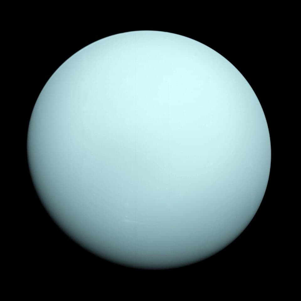
Its axis is tilted nearly 98°, so the planet rolls along its orbit rather than spinning upright.
Voyager 2 in 1986, the only spacecraft ever to fly past Uranus.
Data source: NASA · JPL
Position #7 from the Sun
Neptune
- Ice giant
- Fastest winds
- 49,244km
- Diameter
- 4,515million km
- Distance from the Sun
- 16
- Moons
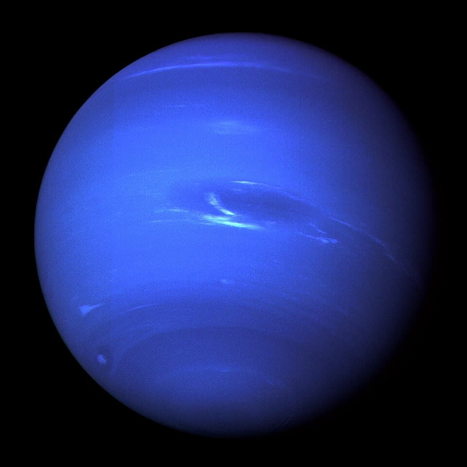
The most distant planet, home to the fastest winds in the Solar System at over 2,000 km/h.
Voyager 2 in 1989. The dark patch is the Great Dark Spot, a storm that had vanished by the time Hubble looked again in 1994.
Data source: NASA · JPL
Position #8 from the Sun
Photographs come from Wikimedia Commons; the licence is named on each one. Surface maps are published as HiPS by CDS (Strasbourg), built from NASA, ESA and USGS data.
Sky imagery by Aladin Lite and the HiPS surveys of CDS (Strasbourg Astronomical Data Centre). Coordinates from SIMBAD.